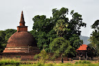
Thanthirimale.
| From Thanthirimale |
තන්තිරිමලය,තන්තිරිමලය,තන්තිරිමලය,
View Larger Map
| From Thanthirimale |
| From butthala |
|
The Mannar Island which occupies an area of 1505.4 square kilometers, has been known historically by names such as, “Manthei”, “Mathota”, “Mahathiththa”, “Mahaputu” “Mawatuthota”. Mannar displays a similarity to the dry desert climate.
There are two main roads leading to Mannar. One is the road passing through Anuradhapura and Madwachchiya, along which 80km should be travelled to reach Mannar. The other is the recently opened road through Puttalam, Eluankulam, Silawatura and the Wilpattu National Park
.From Mannar
The History of Mannar.
There exist many legends and beliefs regarding the History of Mannar. It is believed that King Vijaya and his retinue had landed in Sri Lanka at this site and that a bride from Madurai was transported between A.D. 505 and 543 across Mannar. (There is also a belief that they had com e here from the area known as Kudiramale, situated at the edge of the Wilpattu Wildlife reserve). Another folk-tale claims that King Ilanaga had escaped to Kerala due to enemy invasions, through Mannar. The Mahawamsa mentions that during the era of Kakusadha Budun, a Bo-tree had been planted at Mahathiththa.
From Mannar
Venkalai Bridge and the Bird-sanctuary
The Venkalai bridge connecting the Mannar Island is the longest island built in Sri Lanka. This bird-sanctuary is located on either side of the bride, between Paliyanthiv and Thirikenilwert, and is 4828 hectares in extent. This place which is a sanctuary of Migratory birds is a haven for about 200 types of birds. Siyakkaraya, Kabiliththa, Ranpath tharawa, Ul peda Tharawa, Petamathabatta are the main types. Apart from them, very rare species of animals have made this place their home, among them are, the Geta Kibula, and Muhudu oora. Mangrove plans and stretches of sand are found all over the Venkalai Sanctuary.From Manna
Thiruketheeswaram Kovil.
Thiruketheeswaram Kovil is one of the famous Kovils built to worship God Eeswara. The others are the Muneshwaram kovil in Halawatha, Koneshwaram Kovil in Trincomale and Rameshwaram of India. This Kovil is situated near the A-32 road. There is a legend that the Kovil was built by Mayan, Ravana’s Uncle, while it is also believed that Rama had worshipped at this temple before travelling to India with Seetha. Another belief among the villagers is that a Brahmin of King Vijaya had worshipped at the temple. The temple is one of the legendary sites where Eeswara had performed many miracles.
Donkeys of Mannar.
Donkeys had been imported to Mannar from Somalia for daft purposes. These donkeys were transported to Puttalam and Kalpitiya too. They can still be seen in herds in the area.
Agriculture in Mannar.
The rainy season of Mannar is only two-months long. The day is much longer too. This climate is favorable for paddy-cultivation. Most of the cultivation is done using rain-water while 24,000 acres are nourished by the water of the Yada Wawa. The red-mixed Latirus soil is perfect for paddy cultivation, while the Data of the Agriculture department show that 170 bushels of paddy are obtained per acre.
Mannar Fort.
The Mannar Fort had been built by the Portuguese. After 1696, the Fort has been controlled by the Dutch. The English captured the fort on October 05 th, 1975. The Mannar port could be described as port that linked Sri Lanka to the world. Details about the Mannar port and fort are found in a stone inscription at Thamanhil island. Presently, the island is controlled by the Sri Lanka police.
Biobas tree.
The Biobas is a huge tree found on the Mannar island. The largest Biobas tree in Mannar is found about 2km from the entrance to Mannar island. The Biobas tree had been the favorite food of Camels brought to the island for draft.
Urumale beachFrom Mannar
Urumale is a beautiful beach situated on the annar island. On a clear day, the light of the light-house situated in Rameshwaram, India could be seen at Urumale. The only place in Sri Lanka from which another country could be seen is the Urumale beach. The closest beach to India is the Urumale beach. The sand-hills of the Adam’s bridge which the legendary Hanumatha had used are seen at Urumale. A variety of fish are present in this sea-strip. Beautiful corals are also seen. Presently, this sea-strip is under the control of the Sri Lanka Navy.
-Chakrith Koththagoda-
| From jaffna town trip |
POINT PADRO , பருத்தித்துறை, පේදුරු තුඩුව
Dambakola Patuna
A text saying, "Lankeshwara Narendra, uttering merry words, got in to water with the people belonging to 16 different castes, bearing the maha bodhi on his head…" can be seen near the 'bodhi' at the entrance to Dambakola Patuna. The wonderful white sandy beach with dents in Dambakola Patuna is added more beauty by the bays making their way in to the land. Dambakola Patuna with its beautiful beach is a most suitable for anyone coming from India or any other country to land in and for us Sri Lankans it is an important place as it was here that Theri Sangamiththa landed in with the Sri Maha Bodhi plant. So it wouldn’t be wrong to call Dambakolapatuna the place through where Buddhism came to Sri Lanka.
Keerimali,கீரிமலை
Kadurugoda temple
Route- if coming from Kiramalei, you have to turn to left from the 'Chunnakam' junction and go toward 'Sankani' to see the 'Kadurugoda' temple which is better known in the area as 'Kandarodei'.
According to the past records, there had been 60 stupas in this temple. The 60 stupas had been built to place the ash of 60 arhath theros from 'Punkudativ'. The Department of Archeology has found 56 of the stupas so far and thus the Kadurugoda temple bears a significant historical importance due to these archeological factors.
The well with no bottom.
The well with no bottom is situated in the Point Pedro- Puthur road and the well is so called because its bottom has not been discovered yet by any. There is a belief that the 'Kiramalei' pond is connected to this well beneath the ground. It is believed so as a lime, put in to this well once, had come up from the Kiramalei pond.
Casuarina beach
The beautiful shallow beach with sand was an extremely popular destination before the war. Paying just Rs 500, you can go on a boat ride in the sea near Casuarina beach.
Few of the places you can visit in Jaffna
Welikandu, Kodikaman kovil, Vallipuram stone inscription, Hanuman kovil are a few of the most popular sites in Jaffna. You can have accommodation facility at the rest house at Naga Viharaya. A single room can be taken at a price between Rs 300 to Rs 500 while a double room can be taken at Rs 750. In addition to that, there are several other places you can select to for accommodation.
| From GALLE FOR Tsunami of 2004 had a devastating effect on Galle Fort. Most of the buildings were either completely destroyed or were damaged to a large extent. Those that were completely destroyed are being rebuilt afresh and those which were damaged are being renovated now. These are being done under the supervision of the Ministry of Cultural Affairs so that the new buildings and the renovations retain the old appearance which was there prior to Tsunami-Imalka |

Audio clip
_____________________________________________________
හුලං නුගේඅම්පාර දිස්ති්රක්කයේ ලාහුගල මැතිවරණ කොට්ඨාසයේ ලාහුගල ජාතික වනෝද්යානය අසබඩ පිහිටි මේ සුන්දර හුදකලා කඳුවැටිය ඓතිහාසික සහ පාරිසරික වැදගත්කම්වලින් අනූන තැනකි. දකුණු ආසියාවේ දිගම කටාරන් කෙටූ ගල් ලෙනත්, ශී්ර ලංකාවේ දෙවැනියට ඉපැරණිම පිළිම වහන්සේත් මෙහි ඇති සුවිශේෂිත්වයන්ය. හුලං නුගේ කඳුවැටිය මුදුනේ ඇති ආකාස ෙඓත්යය අසල සිට නැෙ`ගනහිර පළාතේ ඈත පොතුවිල් මුහුදු තීරයත් අනෙක් පසින් ඌව පළාතේ නමුනුකුල කඳුවැටියත් හතර වටේ ලාහුගල වනෝද්යානයේ සහ සුන්දර හුලං නුගේ කෙත් යායේ නෙත් පහසත් විදිමින් වරුවක් ගත කරන්න හුලං නුගේ යන්න. සිවුවරු මුල්ලේ ලොකු හාමුදුරුවන් ඔබව සතුටින් පිළිගන්න බලා සිටින බව නිසැකයි
View Larger Map
| From Mannar 02 |
| From Mannar තිරුකේතීස්වරම් කෝවිල |
| From Mannar 02 |